How Is A Map Different From A Globe
News Leon
Mar 24, 2025 · 4 min read
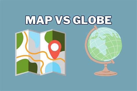
Table of Contents
How is a Map Different from a Globe? A Comprehensive Comparison
Maps and globes, both crucial tools for understanding our world, often get conflated. While they share the common goal of representing the Earth's geography, their inherent differences significantly impact their functionality and applications. This comprehensive guide will delve into the key distinctions between maps and globes, highlighting their unique advantages and limitations.
Fundamental Differences: Projection vs. Three-Dimensional Representation
The most significant difference lies in their representation of the Earth's spherical surface. A globe is a three-dimensional model of the Earth, accurately portraying its curvature and relative sizes of landmasses and oceans. This true-to-scale representation makes it ideal for visualizing the planet's overall shape and the spatial relationships between different locations.
In contrast, a map is a two-dimensional representation of the Earth's surface. Because it's impossible to perfectly flatten a sphere onto a plane without distortion, mapmakers use various map projections. These projections mathematically transform the three-dimensional globe onto a two-dimensional surface, inevitably introducing some level of distortion in area, shape, distance, or direction, or a combination thereof.
This inherent distortion is a crucial factor when comparing maps and globes. While globes provide a flawless representation of Earth's curvature, maps, depending on their projection, may significantly misrepresent the relative sizes and shapes of continents and countries. For instance, a map using a Mercator projection, commonly used for navigation, exaggerates the size of landmasses near the poles while minimizing the size of those near the equator.
Distortion and its Implications: A Closer Look at Map Projections
The choice of map projection significantly impacts a map's accuracy and usefulness. Different projections optimize for different properties, leading to trade-offs. Understanding these projections is vital for interpreting map data correctly. Let's examine a few common types:
1. Mercator Projection:
- Strengths: Preserves direction and shape locally, making it ideal for navigation. Straight lines represent constant compass bearings.
- Weaknesses: Severely distorts area, particularly at higher latitudes. Greenland, for example, appears much larger than South America, even though it's significantly smaller in reality.
2. Gall-Peters Projection:
- Strengths: Preserves area accurately, providing a more truthful representation of the relative sizes of landmasses.
- Weaknesses: Distorts shape, particularly near the poles. This can make it less useful for navigation.
3. Robinson Projection:
- Strengths: A compromise projection that attempts to balance distortions in area, shape, distance, and direction. It's aesthetically pleasing and often used in atlases.
- Weaknesses: Doesn't perfectly preserve any single property; it's a balance of compromises.
4. Winkel Tripel Projection:
- Strengths: Another compromise projection, it minimizes overall distortion across different aspects. It's widely used by National Geographic.
- Weaknesses: Still introduces some distortion, though it's generally considered a good all-around choice.
The existence of numerous projections underscores the fundamental challenge of translating a three-dimensional object onto a two-dimensional surface. This inherent limitation of maps, absent in globes, must be considered when using them for analysis or decision-making.
Practical Applications: Where Each Excels
Both maps and globes offer unique advantages depending on the application.
Globes shine when:
- Visualizing the Earth's spherical nature: The three-dimensional representation allows for an intuitive understanding of the planet's curvature and the relationships between continents and oceans.
- Teaching geography: Globes are excellent tools for education, helping students visualize geographical concepts like latitude, longitude, and hemispheres.
- Illustrating global phenomena: They are ideal for presenting phenomena that span the entire globe, such as climate patterns or tectonic plates.
- Simple comparative analysis: Quickly comparing the relative sizes of countries and continents.
Maps excel when:
- Detailed regional analysis: Maps allow for a higher level of detail when focusing on specific regions or countries.
- Navigation and route planning: Specialized maps, particularly those using Mercator projection, are indispensable for navigation.
- Thematic mapping: Maps are powerful tools for displaying specific data, such as population density, rainfall patterns, or election results (thematic maps).
- Portability and convenience: Maps are easily portable and readily available in various formats (printed, digital).
- Specific data representation: Maps can be tailored to highlight specific information, unlike a globe which offers a general overview.
Beyond the Basics: Digital Maps and Their Impact
The advent of digital maps has further blurred the lines between maps and globes. Interactive digital globes, like Google Earth, combine the advantages of both: They provide a three-dimensional view of the Earth while allowing for zoom capabilities and detailed thematic overlays, offering a level of flexibility and data integration beyond traditional maps and globes.
Conclusion: A Synergistic Relationship
While maps and globes differ fundamentally in their representation of the Earth, they are not mutually exclusive. They are complementary tools that serve different purposes. Globes provide an accurate, holistic view of our planet's spherical nature, while maps offer detailed representations of specific regions and data. Understanding their strengths and limitations is key to using them effectively for various applications, from education and navigation to geographical analysis and data visualization. The best choice ultimately depends on the specific task or information being sought. In many cases, a synergistic approach, using both globes and maps, offers the most comprehensive understanding of our world.
Latest Posts
Latest Posts
-
What Disappears The Moment You Say It
Mar 29, 2025
-
Microscopic Study Of Tissues Is Called
Mar 29, 2025
-
What Are Characteristics Of A Base
Mar 29, 2025
-
What Phase Is The Reverse Of Prophase
Mar 29, 2025
-
Mechanical Advantage Of A 1st Class Lever
Mar 29, 2025
Related Post
Thank you for visiting our website which covers about How Is A Map Different From A Globe . We hope the information provided has been useful to you. Feel free to contact us if you have any questions or need further assistance. See you next time and don't miss to bookmark.
